




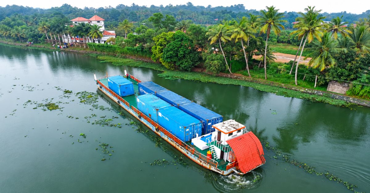

Kottayam Port and Container Terminal Services (KPACT) has proposed a 180-km waterborne container corridor to Vizhinjam International Seaport, aiming to give businesses in Central Kerala an alternative to road transport. The plan would combine inland waterways with a coastal sea passage to connect Kottayam’s cargo-handling facilities with Vizhinjam’s international shipping network.
A preliminary survey has reportedly been completed. A secondary survey is expected to begin by January 2027, following consultations with the Kerala government. The corridor remains a proposal, with infrastructure requirements and operating arrangements still to be developed.
How would the Kottayam–Vizhinjam corridor work?
The proposal envisages using National Waterway 9 (NW-9) and National Waterway 3 (NW-3), together with connected river and backwater stretches. The project description identifies Munroe Island, Ashtamudi Lake, the Pamba River, Ambalappuzha, Thottappally and Thrikkunnapuzha among the locations associated with the route.
Barges would reach Valiyazheekkal before entering the Arabian Sea for the coastal passage towards Vizhinjam. The final navigational alignment would need to be established through the survey and planning process.
KPACT estimates a journey time of approximately 12–14 hours. This is a proposed operating estimate, rather than a transit time demonstrated by a scheduled commercial service.
The sea leg is an important feature of the plan. Although presented as an inland waterway corridor, the complete connection would involve both inland navigation and coastal movement.
Why is the Thrikkunnapuzha lock important?
A lock system near the Thrikkunnapuzha bridge is a central infrastructure component of the proposal. It is intended to facilitate barge passage through the waterway and support container movements along the corridor.
The preliminary survey provides a starting point for assessing the route. Further work will need to establish how the proposed service can operate across the connected waterways and the sea approach to Vizhinjam.
The January 2027 timeline relates to the anticipated secondary survey. It should not be interpreted as a confirmed launch date for container services.
The available proposal does not establish a final investment requirement, vessel capacity, sailing frequency or tariff. These details will determine the scale and commercial structure of any eventual service.
What existing waterways would support the project?
The Ministry of Ports, Shipping and Waterways identifies NW-9 as the Alappuzha–Kottayam–Athirampuzha Canal. NW-3 includes the West Coast Canal between Kottapuram and Kollam, together with the Champakara and Udyogmandal canals.
These waterways provide an established network on which a container corridor could be developed. Their designation, however, does not by itself confirm that every stretch of the proposed route is ready for the vessels and cargo configurations envisaged.
Kerala’s Economic Review places the state’s inland waterway network at approximately 1,687 km, comprising national waterways and feeder or connecting canals maintained by state agencies. The KPACT proposal seeks to connect part of that network with a deep-sea shipping gateway.
What could the corridor offer cargo owners?
For businesses around Kottayam and Central Kerala, the proposed service could create an additional route for moving containerised cargo to Vizhinjam. Consolidating shipments at an inland terminal and transporting them by barge could reduce reliance on long-distance truck movements.
Potential benefits include fewer road journeys and more transport options for exporters and importers. Actual savings would depend on cargo volumes, barge utilisation, terminal handling charges, service frequency and the cost of connecting movements.
The next stage is therefore to translate the route concept into an operating plan. Surveys, the Thrikkunnapuzha lock and coordination with the relevant authorities will be important steps before cargo owners can assess the corridor against existing road-based services.
 Join our WhatsApp channel for more updates:
 Subscribe to our YouTube channel for more updates: